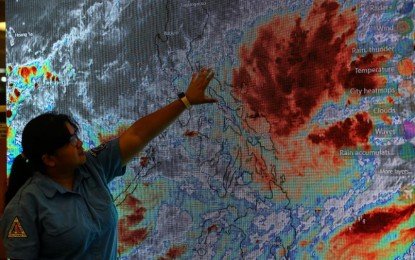
Work in government offices and classes at all levels in the entire island of Luzon is suspended on Wednesday (October 23) due to Tropical Storm “Kristine.”
“In view of the inclement weather brought about by Tropical Storm “Kristine” affecting the whole country, particularly the Island of Luzon, work in government offices and classes at all levels in Luzon are hereby suspended on 23 October 2024,” Executive Secretary Lucas Bersamin said in a statement Tuesday night.
“However, those agencies whose functions involve the delivery of basic and health services, preparedness/response to disasters and calamities, and/or the performance of other vital services shall continue with their operations and render the necessary services,” he added.
On the other hand, the suspension of work for private companies and offices is discretionary.
As of 11 p.m. of Tuesday, Kristine was last located 345 kilometers (km) east northeast of Daet, Camarines Norte or 475 km. east of Infanta, Quezon, packing maximum sustained winds of 75 km per hour (kph) near the center and gustiness of up to 90 kph.
It is moving northwestward at 10 kph and is expected to make landfall over Isabela province as a severe tropical storm on Wednesday evening.
AREAS UNDER SIGNAL NO. 1 AND NO. 2
Also as of Tuesday night, according to Philippine Atmospheric, Geophysical and Astronomical Services Administration (PAGASA), Tropical Cyclone Wind Signal No. 2 is hoisted over Catanduanes, the eastern portion of Camarines Norte (Basud, Daet, Talisay, Vinzons, Paracale, and Mercedes), the eastern portion of Camarines Sur (Caramoan, Presentacion, Garchitorena, Tinambac, Siruma, Lagonoy, Goa, San Jose, Saglay, and Tigaon), the eastern portion of Albay (Rapu-Rapu, Bacacay, City of Tabaco, Malilipot, Malinao, and Tiwi) and the eastern portion of Sorsogon (Barcelona, Gubat, and Prieto Diaz), the northeastern portion of Northern Samar (Palapag, Mapanas, Gamay, Laoang, Catubig, Lapinig, Pambujan, and San Roque) and the northern portion of Eastern Samar (Jipapad, San Policarpo, and Arteche).
Gale-force winds will prevail in those areas.
Strong winds will prevail in areas under signal no. 1: Ilocos Norte, Ilocos Sur, La Union, Pangasinan, Apayao, Kalinga, Abra, Mountain Province, Ifugao, Benguet, Cagayan including Babuyan Islands, Isabela, Quirino, Nueva Vizcaya, Aurora, Nueva Ecija, Tarlac, Zambales, Bataan, Pampanga, Bulacan, Metro Manila, Cavite, Laguna, Batangas, Rizal, Quezon including Pollilo Islands, Occidental Mindoro including Lubang Islands, Oriental Mindoro, Masbate including Ticao and Burias Islands, Marinduque, Romblon, the rest of Camarines Norte, the rest of Camarines Sur, the rest of Albay, and the rest of Sorsogon, rest of Eastern Samar, the rest of Northern Samar, Samar, Leyte, Biliran, and Southern Leyte, Dinagat Islands and Surigao del Norte including Siargao – Bucas Grande.
The cyclone is forecast to move generally northwestward until it makes landfall over Isabela or northern Aurora either Wednesday or Thursday.
It is likely to exit the Philippine Area of Responsibility on Friday, PAGASA said.
(PHOTO FROM PNA)


